East Texas Braces for Extreme Heat, Severe Storms, and Downpours
There are many moving parts to the East Texas forecast for the next seven days. Severe weather could bring large hail and tornadoes, there's the possibility of heavy rain...again, and even though a cool front is coming, get ready for the hottest day of the year (so far).
Let's Start With The Hot Temperatures
Ninety-degree weather in early May is nothing too out of the ordinary for this part of the Pineywoods. However, the relative humidity will skyrocket on Wednesday and Thursday giving much of Deep East Texas heat index readings of 100 degrees or higher.
Thankfully, a cool front is pushing this way and we should return to high temperatures in the low to mid-80s for the weekend.
Severe Weather Outbreak in East Texas
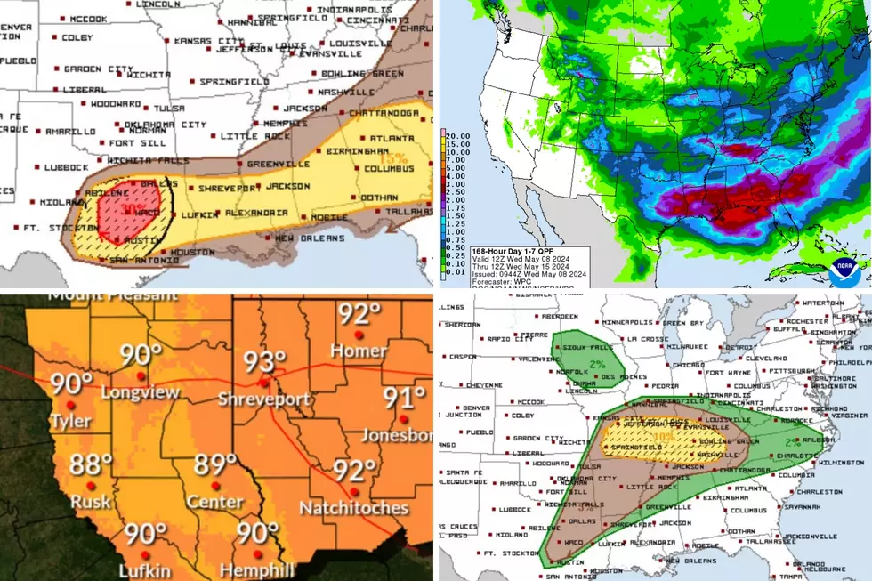
The active severe weather outbreak that has been taking place over much of the nation's midsection for the past week is expected to continue.
Anywhere that's shaded dark green, yellow, brown, or red is at risk of severe weather on Wednesday. Places like Dallas and Little Rock, and especially Nashville, are expected to experience the worst of it.
The National Weather Service shows Lufkin with only an 8% chance of rain on Wednesday afternoon, but, if something does develop, it could become severe.
What About Tornadoes?
Lufkin and Nacogdoches are right along the periphery of the 2-5% tornado zone. That means that you have less than a 5% chance of a tornado occurring within 25 miles of you. It's a small probability, but you should still monitor the weather.
What Is Thursday Looking Like?
The Interstate 35 corridor from Austin to Dallas has an enhanced risk of severe weather on Thursday, that's a 3 on a scale of 1-5. All of Deep East Texas is in the yellow, or slight risk area. That's a 2 on the same scale.
What's the Biggest Threat on Thursday?
Right now, large hail is the biggest severe weather threat for Texas on Thursday. Anyone living in the 'hatched' area of the map above could receive hail that's at least the size of ping pong balls.
Thankfully, the tornado threat from Thursday's severe weather appears to be minimal. There is only a 2% chance of a twister occurring within 25 miles of a given point within the green-shaded area.
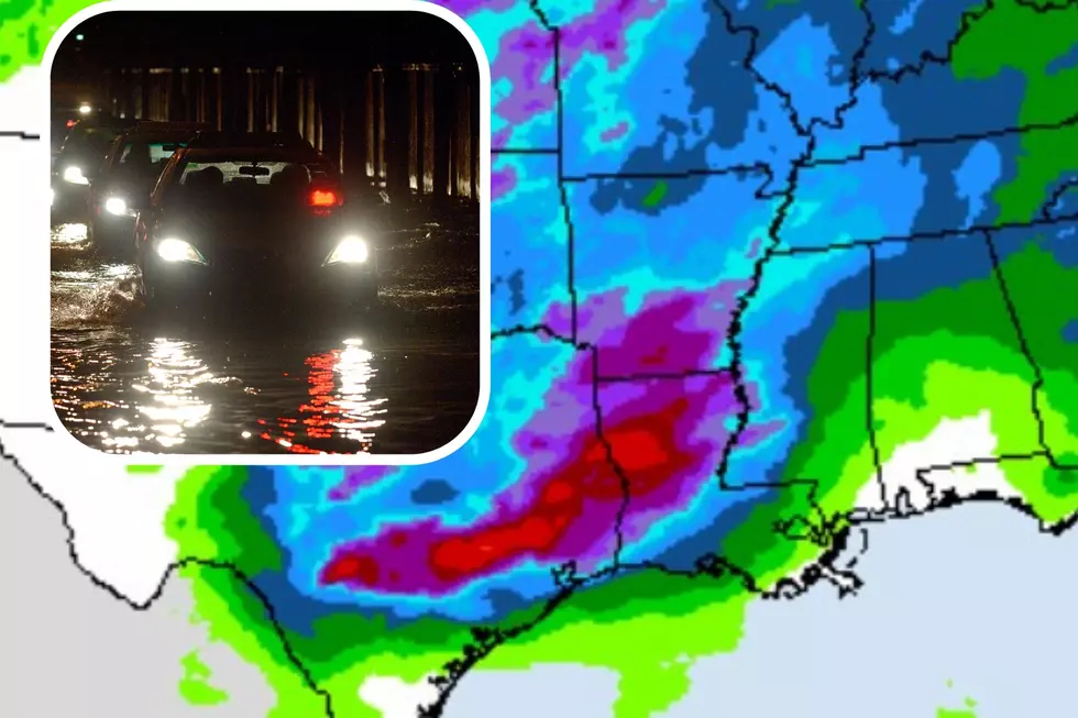
Heavy Downpours and Flooding?
The map above from the Weather Prediction Center shows the expected accumulated rainfall through next Wednesday morning. It appears that much of the Pineywoods could receive 2 to 5 inches of rain through that period. That's the last thing we need following the monster amounts of rain that have recently fallen over East Texas.
The good news is that massive amounts of rain over a short period of time are not expected. East Texas will get downpours, but, hopefully, the storms will not 'train' across the same area over and over. Of course, given the saturation level of the ground, minor to moderate flooding could occur with some of these cloudbursts.
Download our free station app to keep up with weather alerts.

LOOK: Gorgeous, Sprawling Farm Land in East Texas is Up For Sale
Gallery Credit: Chance Turner w/ Hortenstine Ranch Company
More From Mix 93.1