East Texas Is At Risk for Dangerous Late Night Tornadoes
2024 Needs to Take Time Out
In the first ten days of the new year, East Texas has experienced some wild weather. A few days ago tornado warnings were issued for portions of the Pineywoods including Polk, Tyler, and Angelina Counties. Severe storms near Rosevine, Texas in Sabine County damaged or destroyed several structures.
If it hasn't been severe storms, we've had gusty winds to deal with. In some cases, the gusts have been measured at 40+ mph.
More Wild Weather On The Way
Over the next week, East Texas will be subjected to more severe storms, more windy weather, and a MAJOR ARCTIC BLAST.
Let's break down the timeline
Thursday afternoon
- It gets windy, warm, and muggy with high temperatures in the low 70s and south winds around 15 mph with gusts to 25 mph. Rain chances will be less than 20%
Thursday night until Midnight
- The chance of rain increases to about 20-30%. A thunderstorm is possible, but not probable. The wind gusts increase to 30 mph.
Early Friday (Midnight until 5 am)
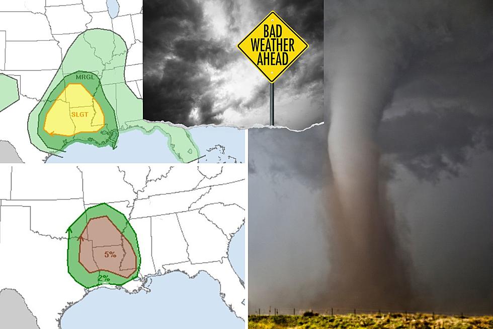
- A worrisome outlook as a strong cold front is expected to fire off severe weather across much of eastern Texas and western Louisiana.
- There will be an 80% chance of storms during this time and winds will shift to the west and gust up to 45 mph.
- Tornadoes, damaging straight-line winds, and hail are all possible. The tornado outlook map below shows the highest probability of twisters occurring in the brown-shaded area.
Friday (6 am until sunset)
- Windy conditions continue with gusts between 30-40 mph. The skies clear but the temperature drops into the 40s later in the day.
Weekend (through late afternoon Sunday)
- Not too bad of a weekend, we will have a low of around 30 Friday night with wind chill readings into the mid-20s. Look for sunshine and highs in the 50s on Saturday and Sunday.
Late Sunday through Tuesday
- The coldest blast of the season is expected to move into East Texas by Sunday evening. There will be a chance of freezing precipitation during the morning hours on Monday. Low temperatures will dip into the teens and wind chill readings will be near zero.
- There is still some uncertainty about freezing rain/sleet/snow chances, but we will update this with a new post in the next 24-48 hours.
Stay Safe
Severe storms are never welcome, but especially when they hit when much of the area's residents are asleep.
If you have a weather radio, great! If not, you can leave your local TV or radio on to receive EAS alerts. Also, download our station app to have alerts sent to your smartphone.

These are the 10 Deadliest Tornadoes to Have Struck Texas Since 1900
Gallery Credit: YouTube, dissolve.com, newspapers.com
More From Mix 93.1